Thursday 23 February 2012

The world's best cities for quality of life

Vienna has again been named as the ‘best’ city in the world, with the Austrian capital’s perennial Swiss rival, Zurich, in second place. Auckland, Munich and Düsseldorf complete the top five. Overall, German-speaking cities occupy six places in the top ten in this year’s Quality of Living Survey

 Compared to 2010, the most prominent changes in Mercer's city rankings are: Munich up from 7th to 4th place; Geneva down from 3rd to 8th place; Hamburg up from 23rd to 16th place; Brussels down from 14th to 22nd place; Paris up from 34th to 30th place; Calgary down from 28th to 33rd place; Barcelona up from 44th to 40th place; Lisbon up from 45th to 41st place; Madrid up from 48th to 43rd place and Tokyo down from 40th to 46th place. Two other Japanese cities, Kobe and Yokohama, both dropped by seven places.

European cities represent over half the cities amongst the top 25 in the ranking. London (38) is the highest-ranking UK city and is followed by Birmingham (52), Aberdeen (54) and Glasgow (56). Belfast (63) is the lowest-ranking of the UK cities that Mercer surveys. Globally, the cities with the lowest quality of living are Khartoum, Sudan (217), Port-au-Prince, Haiti (218), N’Djamena, Chad (219), and Bangui, Central African Republic (220). Baghdad, Iraq (221) ranks last in Mercer’s table.

This year, the survey separately identifies those cities with the highest personal safety ranking based on internal stability, crime levels, law enforcement effectiveness and the host country’s international relations. Luxembourg tops this personal safety ranking, followed by Bern, Helsinki and Zurich – all ranked at number two. Vienna ranks fifth, while Geneva and 
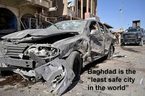
Stockholm both rank sixth. Baghdad (221) is the world’s least safe city, followed by N’Djamena, Chad (220), Abidjan, Côte d'Ivoire (219), Bangui, Central African Republic (218), and Kinshasa, Democratic Republic of the Congo (217).


The world's best cities for quality of life
(New York City is the base city with a score of 100 points)
2011 Rank
2010 Rank
City
Country
1
1
Vienna Austria
2
2
Zurich Switzerland
3
=4
Auckland New Zealand
4
=7
Munich Germany
=5
6
Düsseldorf Germany
=5
=4
Vancouver Canada
7
=7
Frankfurt Germany
8
3
Geneva Switzerland
=9
9
Bern Switzerland
=9
11
Copenhagen Denmark
11
10
Sydney Australia
12
13
Amsterdam Netherlands
13
12
Wellington New Zealand
14
14
Ottawa Canada
15
16
Toronto Canada
16
23
Hamburg Germany
17
17
Berlin Germany
18
18
Melbourne Australia
19
19
Luxembourg Luxembourg
20
20
Stockholm Sweden
21
21
Perth Australia
=22
14
Brussels Belgium
=22
=21
Montreal Canada
24
-24
Nürnberg Germany
25
=28
Singapore Singapore
=26
=26
Canberra Australia
=26
=26
Dublin Ireland
28
30
Stuttgart Germany
29
31
Honolulu USA
=30
=32
Adelaide Australia
=30
34
Paris France
=30
=32
San Francisco USA
=33
=28
Calgary Canada
=33
=24
Oslo Norway
35
35
Helsinki Finland
36
37
Boston USA
37
36
Brisbane Australia
38
39
London UK
39
38
Lyon France
40
44
Barcelona Spain
41
=45
Lisbon Portugal
42
=41
Milan Italy
=43
=45
Chicago USA
=43
48
Madrid Spain
=43
=45
Washington DC USA
46
40
Tokyo Japan
47
49
New York City USA
48
50
Seattle USA
=49
=41
Kobe Japan
=49
-
Pittsburgh USA
=49
=41
Yokohama Japan
Research by Mercer Consulting

The EIU's list of 'best' cities in the world


The Americas
Canadian cities dominate the top of the ranking for this region. Vancouver (5) has the best quality of living and is followed by Ottawa (14), Toronto (15) and Montreal (22). Honolulu (29) and San Francisco (30) are the highest-ranking US cities. In Central and South America, Pointe-à-Pitre, Guadeloupe (63), ranks highest, followed by San Juan, Puerto Rico (72), and Montevideo, Uruguay (77). Port-au-Prince, Haiti (218), ranks lowest in the region.

Canadian cities also dominate the higher end of the personal safety ranking for this region, with Calgary, Montreal, Ottawa, Toronto and Vancouver all ranked jointly at 17. In the United States, Chicago, Honolulu, Houston and San Francisco all rank 53. Pointe-à-Pitre, Guadeloupe (40), is again the highest-ranking city in Central and South America, followed by Nassau, Bahamas (66), San Juan, Puerto Rico (79), and Panama City, Panama (92). At the other end of the personal-safety scale, Caracas, Venezuela (205), Port-au-Prince, Haiti (202), Bogotá, Colombia (196), and Kingston, Jamaica (192), rank lowest in the region.

City Mayors was told that the disparity in living standards between North and South America were still considerable. "Though a number of South and Central American countries have experienced positive change, political and safety issues predominate in the region. In particular, drug trafficking, drugs cartels and high levels of street crime, combined with natural disasters, continue to impair the region’s quality of living,” the Mercer spokesman explained.

Europe
Vienna is the European city with the highest quality of living. German and Swiss cities dominate the top of the ranking, with three cities each in the top 10. Zurich (2) is followed by Munich (4), Düsseldorf (5), Frankfurt (7) and Geneva (8), while Bern shares ninth place with Copenhagen.

In the next tier are Amsterdam (12), Hamburg (16), Berlin (17), Luxembourg (19), Stockholm (20), Brussels (22), Nurnberg (24) and Dublin (26). Paris ranks 30 and is followed by Oslo (33), Helsinki (35) and London (38). Lisbon is number 41, Madrid is at 43 and Rome ranks 52. Prague, Czech Republic (69), is the highest-ranking eastern European city, followed by Budapest, Hungary (73), Ljubljana, Slovenia (75), Vilnius, Lithuania (79), and Warsaw, Poland (84). The lowest-ranking European city is Tbilisi, Georgia (214).

With seven cities in the top 10, European cities also fare well in the personal safety ranking. Luxembourg ranks highest, followed by Bern, Helsinki and Zurich, which all rank second. Vienna (5) is ahead of jointly ranked Geneva and Stockholm (6). Berlin ranked 36th, while London is in 68th place. A Mercer spokesman told City Mayors, that the August 2011 riots in London were noted but, because they only lasted a few days, had no impact on the UK capital's ranking. In Eastern Europe, Ljubljana (30) and Prague (47) rank highest for personal safety, whereas Moscow (199) and Tbilisi (215) rank lowest.

A Mercer spokesman said: “European cities in general continue to have high standards of living, because they enjoy advanced and modern city infrastructures combined with high-class medical, recreational and leisure facilities. But economic turmoil, high levels of unemployment and lack of confidence in political institutions make their future positions hard to predict. Countries such Austria, Germany and Switzerland still fare particularly well in both the quality of living and personal safety rankings, yet they are not immune from decreases in living standards if this uncertainty persists.”

Asia-Pacific
Auckland (3) is the highest-ranking city for quality of living in the Asia-Pacific region and is followed by Sydney (11), Wellington (13), Melbourne (18) and Perth (21). The highest-ranking Asian cities are Singapore (25) and Tokyo (46). Hong Kong (70), Kuala Lumpur (76), Seoul (80) and Taipei (85) are other major Asian cities ranked in the top 100. Meanwhile, Dhaka, Bangladesh (204), Bishkek, Kyrgyzstan (206), and Dushanbe, Tajikistan (208), rank lowest in the region.

At 8, Singapore ranks highest for personal safety, followed by Auckland and Wellington – both ranked 9. Canberra, Melbourne, Perth and Sydney all rank 25, and all the Japanese cities on the list (Tokyo, Kobe, Nagoya, Osaka and Yokohama) rank 31. The region’s lowest-ranking city for personal safety is Karachi, Pakistan (216).

As a region, Asia Pacific is highly diverse. Countries such as Australia, New Zealand and Singapore dominate the top of both the general and personal safety rankings, in part because they have been continuously investing in infrastructure and public services. In general, the region has seen a greater focus on city planning. Nevertheless, many Asian cities rank at the bottom, mainly due to social instability, political turmoil, natural disasters such as typhoons and tsunamis, and lack of suitable infrastructure for expatriates.

Middle East and Africa
Dubai, UAE (74), ranks highest for quality of living across the Middle East and Africa and is followed by Abu Dhabi, UAE (78), Port Louis, Mauritius (82), and Cape Town, South Africa (88). Johannesburg ranks 94 and is followed by Victoria, Seychelles (95), Tel Aviv (99), Muscat, Oman (101), and Doha, Qatar (106). Africa has 18 cities in the bottom 25, including Bangui, Central African Republic (220), N’Djamena, Chad (219), Khartoum, Sudan (217), and Brazzaville, Congo (214). Baghdad (221) is the lowest-ranking city both regionally and globally.

At 23, Abu Dhabi has the highest personal safety ranking in the Middle East and is followed by Muscat (29), Dubai (39), and Doha (67). Port Louis (59) and Victoria (79) are the only African cities in the top 100. Elsewhere in the region, Tunis, Tunisia, ranks 140, Casablanca, Morocco, is at 147 and Cairo ranks 176. At 185, Algiers is followed by Tehran (188), and towards the bottom of the list is Tripoli (204). In terms of personal safety, Baghdad (221) is the lowest-ranking city regionally and globally, along with N’Djamena, Chad (220), Abidjan, Côte d’Ivoire (219), Bangui, Central African Republic (218), and Kinshasa, Democratic Republic of the Congo (217).

City Mayors was told by Mercer that the recent wave of violent protests across North Africa and the Middle East has temporarily lowered living standards in the region. Many countries such as Libya, Egypt, Tunisia and Yemen have seen their quality of living levels drop considerably. "Political and economic reconstruction in these countries, combined with funding to serve basic human needs, will undoubtedly boost the region as a key player in the international arena. It is also worth noting that some of this region's cities, including Abu Dhabi, Dubai and Muscat, rank quite high on the personal safety list. This is mainly due to their internal stability and low crime levels."

The world's 'safest' cities
(Research criteria: Mercer’s Personal Safety Ranking 2011 is based on measures of internal stability, crime levels, law enforcement effectiveness and host country international relations)

2011 Rank
City
Country
1
Luxembourg Luxembourg
=2
Bern Switzerland
=2
Helsinki Finland
=2
Zurich Switzerland
5
Vienna Austria
=6
Geneva Switzerland
=6
Stockholm Sweden
8
Singapore Singapore
=9
Auckland New Zealand
=9
Wellington New Zealand
=11
Copenhagen Denmark
=11
Düsseldorf Germany
=11
Frankfurt Germany
=11
Munich Germany
=11
Nürnberg Germany
16
Dublin Ireland
=17
Amsterdam Netherlands
=17
Calgary Canada
=17
Montreal Canada
=17
Ottawa Canada
=17
Toronto Canada
Research


Research methodology
Mercer Consulting largely between September and November 2011 and is regularly updated to take account of changing circumstances. In particular, the assessments are revised in the case of significant political, economic and environmental developments.

Mercer evaluates local living conditions in all the 420 cities it surveys worldwide. Living conditions are analysed according to 39 factors, grouped in 10 categories:
1) Political and social environment (political stability, crime, law enforcement, etc)
2) Economic environment (currency exchange regulations, banking services, etc)
3) Socio-cultural environment (censorship, limitations on personal freedom, etc)
4) Health and sanitation (medical supplies and services, infectious diseases, sewage, waste disposal, air pollution, etc)
5) Schools and education (standard and availability of international schools, etc)
6) Public services and transportation (electricity, water, public transport, traffic congestion, etc)
7) Recreation (restaurants, theatres, cinemas, sports and leisure, etc)
8) Consumer goods (availability of food/daily consumption items, cars, etc)
9) Housing (housing, household appliances, furniture, maintenance services, etc)
10) Natural environment (climate, record of natural disasters)

The scores attributed to each factor allow for city-to-city comparisons. The result is a quality-of-living index that compares relative differences between any two locations. For the indices to be used effectively, Mercer has created a grid that allows users to link the resulting index to a quality-of-living allowance amount by recommending a percentage value in relation to the index.

River Thames

The River Thames (Listeni/ˈtɛmz/ temz) flows through southern England. It is the longest river entirely in England and the second longest in the United Kingdom. While it is best known because its lower reaches flow through central London, the river flows alongside several other towns and cities, including Oxford, Reading, Henley-on-Thames, Windsor, Kingston upon Thames and Richmond.
The river gives its name to several geographical and political entities including the Thames Valley, a region of England centred around the river between Oxford and west London, the Thames Gateway, the area centred around the tidal Thames, and the Thames Estuary to the east of London.

Summary


Bird's-eye view of central London and the River Thames.
With a total length of 346 km (215 mi), the Thames is the longest river entirely in England and the second longest in the United Kingdom. It rises at Thames Head in Gloucestershire, and flows into the North Sea at the Thames Estuary. It has a special significance in flowing through London, the capital of the United Kingdom, although London only includes a short part of its course. The river is tidal in London with a rise and fall of 7 metres (23 ft); tides reaching up to Teddington Lock. The catchment area covers a large part of South Eastern and Western England and the river is fed by over 20 tributaries. The river contains over 80 islands, and having both seawater and freshwater stretches, it supports a variety of wildlife.
The river has supported human activity from its source to its mouth for thousands of years providing habitation, water power, food and drink. It has also acted as a major highway through the Port of London for international trade, internally along its length and by its connection to the British canal system. The river’s strategic position has seen it at the centre of many events and fashions in British history, earning it a description by John Burns as “Liquid History”. It has been a physical and political boundary over the centuries and generated a range of river crossings. More recently, the river has become a major leisure area supporting tourism and pleasure outings as well as the sports of rowing, sailing, skiffing, kayaking, and punting. The river has had a special appeal to writers, artists, musicians and film-makers and is well-represented in the arts. It is still the subject of various debates about its course, nomenclature and history.

[edit] Etymology

The Thames, from Middle English Temese, is derived from the Celtic name for the river, Tamesas (from *tamēssa),[1] recorded in Latin as Tamesis and underlying modern Welsh Tafwys "Thames". The name probably meant "dark" and can be compared to other cognates such as Sanskrit tamas, Irish teimheal and Welsh tywyll "darkness" (Proto-Celtic *temeslos) and Middle Irish teimen "dark grey",[1] though Richard Coates[2] mentions other theories: Kenneth Jackson's[3] that it is non Indo-European (and of unknown meaning), and Peter Kitson's[4] that it is IE but pre-Celtic, and has a name indicating muddiness from a root *tã-, 'melt'.

Statue of Old Father Thames by Raffaelle Monti at St John's Lock
Note also other river names such as Teme, Tavy, Teviot, Teifi (cf Tafwys).
The river's name has always been pronounced with a simple t /t/; the Middle English spelling was typically Temese and Celtic Tamesis. The th spelling lends an air of Greek to the name and was added during the Renaissance, possibly to reflect or support a claim that the name was derived from River Thyamis in the Epirus region of Greece, whence early Celtic tribes were erroneously thought to have migrated.
Indirect evidence for the antiquity of the name 'Thames' is provided by a Roman potsherd found at Oxford, bearing the inscription Tamesubugus fecit (Tamesubugus made this). It is believed that Tamesubugus' name was derived from that of the river.[5]
The Thames through Oxford is sometimes given the name the River Isis. Historically, and especially in Victorian times, gazetteers and cartographers insisted that the entire river was correctly named the River Isis from its source down to Dorchester-on-Thames, and that only from this point, where the river meets the River Thame and becomes the "Thame-isis" (supposedly subsequently abbreviated to Thames) should it be so called. Ordnance Survey maps still label the Thames as "River Thames or Isis" down to Dorchester. However since the early 20th century this distinction has been lost in common usage even in Oxford, and some historians suggest the name Isis—although possibly named after the Egyptian goddess of that name—is nothing more than a contraction of Tamesis, the Latin (or pre-Roman Celtic) name for the Thames.
Richard Coates suggests that while the river was as a whole called the Thames, part of it, where it was too wide to ford, was called *(p)lowonida. This gave the name to a settlement on its banks, which became known as Londinium, from the Indo-European roots *pleu- "flow" and *-nedi "river" meaning something like the flowing river or the wide flowing unfordable river.[2]
Another theory of the origin of the name was published in 2009.[6] Many ancient watery words and river names begin with a vowel, especially A. Examples include Latin amnis (big stream) and aqua, rivers Avon, Amber, Amstel, etc. Among those many rivers is the one variously called Ems (German), Emme (Switzerland), Eems, Ames (Dutch) or Amnis (Latin). The latter rivers are characterised by a big estuary or water body. From around its mouth people migrated up the Thames estuary, as early Anglo-Saxon settlers. People also left that area in the period of sea level rise before 100 BC and known as the Dunkirk 1B transgression, about when Belgae arrived in Britain according to Julius Caesar. In their region of origin they would have spoken a Germanic language, in which a locative preposition 'te', ancestral to English "at", could have supplied an initial T to 'eems' creating Temse or Temese. If so, Thames originally meant ‘at the place where the estuary begins’ and would originally not refer to the river itself but to the place where people settled (actually: London) just upstream of the dangerous tidal zone. There, travellers could be ferried to the other side. Therefore some travellers began to speak about the 'Tems' ("at the eems") as a specific (ferry-) section of the river, extending later the name to the whole river.
Tamese was referred to as a place, not a river in the Ravenna Cosmography.
For merchant seamen, the Thames has long been just 'the London River'. Londoners often refer to it simply as 'the river', in expressions such as 'south of the river'.[7]

[edit] Physical and natural aspects

[edit] Course of the river


The marker stone at the official source of the River Thames near Kemble

River Thames Flood Barrier.

The Thames passes by some of the sights of London, including the Houses of Parliament and the London Eye.
The usually quoted source of the Thames is at Thames Head (at grid reference ST980994). This is about a mile north of the village of Kemble in southern Gloucestershire, near the town of Cirencester, in the Cotswolds.[8] Seven Springs near Cheltenham, where the river Churn rises, is also sometimes quoted as the Thames' source,[9] as this location is furthest from the mouth, and adds some 14 miles (23 km) to the length. The springs at Seven Springs also flow throughout the year, while those at Thames Head are only seasonal. The Thames is the longest river entirely in England, but the River Severn, which is partly in Wales, is the longest river in the United Kingdom. However, as the Churn, sourced at Seven Springs is 14 miles longer than the Thames (from its traditional source at Thames head), its length (229 mi) is greater than the Severn’s length (220 mi). Thus, the Churn/Thames river may be regarded as the longest natural river flow in the United Kingdom.
The Thames flows through or alongside Ashton Keynes, Cricklade, Lechlade, Oxford, Abingdon, Wallingford, Goring-on-Thames, Reading, Henley-on-Thames, Marlow, Maidenhead, Windsor, Eton, Staines, Sunbury, Weybridge and Thames Ditton before entering the Greater London area. The present course is the result of several minor redirections of the main channel around Oxford, Abingdon and Maidenhead and more recently the creation of specific cuts to ease navigation.
From the outskirts of Greater London, the river passes Hampton Court, Surbiton, Kingston, Teddington, Twickenham, Richmond (with a famous view of the Thames from Richmond Hill), Syon House and Kew before flowing through central London. In central London, the river forms one of the principal axes of the city, from the Palace of Westminster to the Tower of London and was the southern boundary of the medieval city, with Southwark on the opposite bank.
Past central London, the river passes between Greenwich and the Isle of Dogs, before flowing through the Thames Barrier, which protects central London from flooding by storm surges. Below the barrier, the river passes Dagenham, Dartford, Tilbury and Gravesend before entering the Thames Estuary near Southend-on-Sea.

[edit] Catchment area and discharge

The Thames River Basin District, including the Medway catchment, covers an area of 16,133 square kilometres (6,229 sq mi).[10] The river basin includes both rural and heavily urbanised areas in the east and northern parts while the western parts of the catchment are predominantly rural. The area is among the driest in the United Kingdom. Water resources consist of ground-water from aquifers and water taken from the Thames and its tributaries, much of it stored in large bank-side reservoirs. The Thames itself provides two thirds of London’s drinking water while groundwater supplies about 40 per cent of public water supplies in the total catchment area. Groundwater is an important water source, especially in the drier months, so maintaining its quality and quantity is extremely important. Groundwater is vulnerable to surface pollution, especially in highly urbanised areas.[10]

[edit] The non-tidal section

Brooks, canals and rivers, within an area of 9,950 square kilometres (3,842 sq mi),[11] combine to form 38 main tributaries feeding the Thames between its source and Teddington Lock, the usual tidal limit. However, high spring tides can raise the head water level in the reach above Teddington and can occasionally reverse the river flow for a short time. In these circumstances, tidal effects can be observed upstream as far as Molesey Weir [12] which is near Hampton Court Palace. Before Teddington Lock was built in 1810–12, the river was tidal as far as Staines. The tributaries of the River Thames include the rivers Churn, Leach, Cole, Ray, Coln, Windrush, Evenlode, Cherwell, Ock, Thame, Pang, Kennet, Loddon, Colne, Wey and Mole. In addition there are many backwaters and distributaries and some man-made channels such as the Longford River.
An artificial secondary channel to the Thames, the Jubilee River, was built between Maidenhead and Windsor for flood relief and completed in 2002[13][14]
The non-tidal section of the river is managed by the Environment Agency which is responsible for both managing the flow of water to control flooding, and providing for navigation. The volume and speed of water down the river is managed by adjusting the gates at each of the weirs and at high water levels are usually dissipated over flood plains adjacent to the river. Occasionally flooding is unavoidable, and the Agency issues Flood Warnings. During heavy rainfall the Thames occasionally receives raw sewage discharge due to sanitary sewer overflow.

[edit] The tidal section


London Stone at Staines, built in 1285 marked the tidal limit of the Thames and the City of London's jurisdiction.

The lower course of the Thames in 1840.
Below Teddington Lock (about 55 miles / 89 kilometres upstream of the Thames Estuary) the river is subject to tidal activity from the North Sea. Before the lock was installed the river was tidal as far as Staines, about 16 miles (26 km) upstream.[15] London, capital of Roman Britain, was established on two hills, now known as Cornhill and Ludgate Hill. These provided a firm base for a trading centre at the lowest possible point on the Thames.[16] A river crossing was built at the site of London Bridge. London Bridge is now used as the basis for published tide tables giving the times of high tide. High tide reaches Putney about 30 minutes later than London Bridge, and Teddington about an hour later. The tidal stretch of the river is known as "the Tideway". Tide tables are published by the Port of London Authority and are available online. Times of high and low tides are also broadcast on Twitter.
The principal tributaries of the River Thames on the Tideway include the rivers Brent, Wandle, Effra, Westbourne, Fleet, Ravensbourne (the final part of which is called Deptford Creek), Lea, Roding, Darent and Ingrebourne. At London, the water is slightly brackish with sea salt, being a mix of sea and fresh water.
This part of the river is managed by the Port of London Authority. The flood threat here comes from high tides and strong winds from the North Sea, and the Thames Barrier was built in the 1980s to protect London from this risk.

[edit] Islands


Temple Island – the start of the Henley Royal Regatta course.
The River Thames contains over 80 islands ranging from the large estuarial marshlands of the Isle of Sheppey, Isle of Grain and Canvey Island to small tree-covered islets like Rose Isle in Oxfordshire and Headpile Eyot in Berkshire. They run all the way from the Isle of Sheppey in Kent to Fiddler's Island in Oxfordshire. Some of the largest inland islands, for example Formosa Island near Cookham and Andersey Island at Abingdon, were created naturally when the course of the river divided into separate streams. In the Oxford area the river splits into several streams across the floodplain (Seacourt Stream, Castle Mill Stream, Bulstake Stream and others), creating several islands (Fiddler's Island, Osney and others). Desborough Island, Ham Island at Old Windsor and Penton Hook Island were artificially created by lock cuts and navigation channels. Chiswick Eyot is a familiar landmark on the Boat Race course, while Glover's Island forms the centrepiece of the spectacular view from Richmond Hill. Islands with a historical interest are Magna Carta Island at Runnymede, Fry's Island at Reading and Pharaoh's Island near Shepperton. In more recent times Platts Eyot at Hampton was the place where MTBs were built, Tagg's Island near Molesey was associated with the impresario Fred Karno, and Eel Pie Island at Twickenham was the birthplace of the South East’s R&B music scene.
Westminster Abbey and the Palace of Westminster (commonly known today as the Houses of Parliament) were built on Thorney Island which used to be an eyot.

[edit] Geological and topographic history


Goring Gap, where the Thames broke through the Chilterns, seen from Lardon Chase.

European LGM refuges, 20,000 years ago. The Thames was a minor river that joined the Rhine, in the southern North Sea basin at this time.
  Solutrean and Proto Solutrean Cultures
  Epi Gravettian Culture
.

Geological map of the London Basin; the London Clay is marked in dark brown.

Lake in Chiswick House grounds fed by the Bollo Brook.[17]

The confluence of Rivers Thames and Brent. The motorised barge is heading up the River Brent. From this point as far as Hanwell the Brent has been canalised and shares its course with the main line of the Grand Union Canal. From Hanwell the Brent can be traced to various sources in the Barnet area.
The River Thames can first be identified as a discrete drainage line as early as 58 million years ago, in the Thanetian stage of the late Palaeocene epoch.[18] Until around 500,000 years ago, the Thames flowed on its existing course through what is now Oxfordshire, before turning to the north east through Hertfordshire and East Anglia and reaching the North Sea near Ipswich. At this time the river system headwaters lay in the English West Midlands and may, at times, have received drainage from the North Wales Berwyn Mountains. Streams and rivers like the River Brent, Colne Brook and Bollo Brook either flowed into the then river Thames or went out to sea on the course of the present-day river Thames.
The arrival of an ice sheet in the Quaternary Ice Age, about 450,000 years ago, dammed the river in Hertfordshire, causing large ice lakes which eventually burst their banks and caused the river to be diverted onto its present course through London. Progressively, the channel was pushed south to form the St Albans depression by the repeated advances of the ice sheet. This created a new river course through Berkshire and on into London, after which the river rejoined its original course in southern Essex, near the present River Blackwater estuary. Here it entered a substantial freshwater lake in the southern North Sea basin. The overspill of this lake caused the formation of the Dover Straits or Pas-de-Calais gap between Britain and France. Subsequent development led to the continuation of the course which the river follows at the present day.[19]
Most of the bedrock of the Vale of Aylesbury is largely made up of clay and chalk that was formed at the end of the ice age and at one time was under the Proto-Thames. Also at this time the vast underground reserves of water that make the water table higher than average in the Vale of Aylesbury were created.
The last advance from that Scandinavian ice flow to have reached this far south covered much of NW Middlesex and finally forced the Proto-Thames to take roughly its present course. At the height of the last ice age around 10,000 BCE, Britain was connected to mainland Europe by a large expanse of land known as Doggerland in the southern North Sea basin. At this time, the Thames' course did not continue to Doggerland, but flowed southwards from the eastern Essex coast where it met the Rhine, the Meuse and the Scheldt[19] flowing from what are now the Netherlands and Belgium. These rivers formed a single river—the Channel River (Fleuve Manche)—that passed through the Dover Strait and drained into the Atlantic Ocean in the western English Channel.
The ice sheet which stopped around present day Finchley, deposited Boulder clay to form Dollis Hill and Hanger Hill. Its torrent of meltwater gushed through the Finchley Gap and south towards the new course of the Thames, and proceeded to carve out the Brent Valley in the process.[20] Upon the valley sides there can be seen other terraces of brickearth; laid over and sometimes interlayered with the clays. These deposits were brought in by the winds during the periglacial periods, suggesting that wide flat marshes were then part of the landscape, which the new river Brent proceeded to cut down. The steepness of the valley sides is witness to the very much lower mean sea levels caused by the glaciation locking up so much water upon the land masses, thus causing the river water to flow rapidly seaward and so erode its bed quickly downwards.
The original land surface was around 110 to 130 metres (350 to 400 ft) above the current sea level. The surface had sandy deposits from an ancient sea, laid over sedimentary clay (this is the Blue London Clay). All the erosion down from this higher land surface and sorting action by these changes of water flow and direction formed what is known as the Thames River Gravel Terraces. Since Roman times and perhaps earlier, however, the isostatic rebound from the weight of previous ice sheets, and its interplay with the eustatic change in sea level, has resulted in the old valley of river Brent, together with that of the Thames, silting up again. Thus along much of the Brent's present-day course one can make out the water meadows of rich alluvium, which is augmented by frequent floods.
After taking its present-day course, much of the banks of the Thames Estuary and the Thames Valley in London was partly covered in marshland, as was the adjoining Lower Lea Valley. The streams and rivers like the River Lea, Tyburn Brook and Bollo Brook drained into the river, while some islands like Thorney Island formed over the ages. The northern tip of the ancient parish of Lambeth, for example, was a marshland known as Lambeth Marshe, but it was drained in the 18th century and is remembered in the Lower Marsh street name. Sometime after the opening of Waterloo railway station in 1848 the locality around the station and Lower Marsh became known as Waterloo. Lower Marsh is a street in the Waterloo neighbourhood of London. It is the location of Lower Marsh Market.[21]
The East End of London, also known simply as the East End, was the area of London east of the medieval walled City of London and north of the River Thames, although it is not defined by universally accepted formal boundaries; the river River Lea can be considered another boundary.[22] Most of the local riverside was also marshland. The land was drained and became farmland; it was built on after the Industrial Revolution. Use of the term "East End" in a pejorative sense began in the late 19th century,[23]
Canvey Island in southern Essex (area 18.45 km²; pop. 37,479[24]) is a civil parish and once marshy, but now fully reclaimed island in the Thames estuary in England. It is separated from the mainland of south Essex by a network of creeks. Lying below sea level it is prone to flooding at exceptional tides, but has nevertheless been inhabited since the Roman invasion of Britain.

[edit] Wildlife


Swan Upping – skiffs surround the swans.

Fishing at Penton Hook Island.
Various species of birds feed off the river or nest on it, some being found both at sea and inland. These include Cormorant, Black-headed Gull, and Herring Gull. The Mute Swan is a familiar sight on the river but the escaped Black Swan is more rare. The annual ceremony of Swan upping is an old tradition of counting stocks. Non-native geese that can be seen include Canada Geese, Egyptian Geese, and Bar-headed Geese, and ducks include the familiar native Mallard, plus introduced Mandarin Duck and Wood Duck. Other water birds to be found on the Thames include the Great Crested Grebe, Coot, Moorhen, Heron, and Kingfisher. Many types of British birds also live alongside the river, although they are not specific to the river habitat.
The Thames contains both sea water and fresh water, thus providing support for seawater and freshwater fish. Salmon, which inhabit both environments, have been reintroduced and a succession of fish ladders have been built into weirs to enable them to travel upstream. On 5 August 1993 the largest non-tidal salmon in recorded history was caught close to Boulters Lock in Maidenhead. The specimen weighed 6.5 kg or 14.5 pounds and measured 88 cm or 22 inches in length. The eel is particularly associated with the Thames and there were formerly many eel traps. Freshwater fish of the Thames and its tributaries include brown trout, chub, dace, roach, barbel, perch, pike, bleak, and flounder. Colonies of short-snouted seahorses have also recently been discovered in the river.[25]
The Thames is also host to some invasive crustaceans, including the signal crayfish and the Chinese Mitten Crab.
On 20 January 2006 a 16–18 ft (5 m) northern bottle-nosed whale was seen in the Thames as far upstream as Chelsea. This was extremely unusual: this whale is generally found in deep sea waters. Crowds gathered along the riverbanks to witness the extraordinary spectacle but there was soon concern, as the animal came within yards of the banks, almost beaching, and crashed into an empty boat causing slight bleeding. About 12 hours later, the whale is believed to have been seen again near Greenwich, possibly heading back to sea. A rescue attempt lasted several hours, but the whale died on a barge. See River Thames whale.[26]

[edit] Human aspects

The River Thames has served several roles in human history, being an economic resource, a water highway, a boundary, a fresh water source, also a source of food and more recently a leisure facility. In 1929 John Burns, one time MP for Battersea, responded to an American's unfavourable comparison of the Thames with the Mississippi by coining the expression "The Thames is liquid history".

[edit] Human history pre-1607


The Tower, with Tower Bridge built 800 years later.

An engraving by Claes Van Visscher showing Old London Bridge in 1616, with Southwark Cathedral in the foreground

The Frozen Thames, 1677.

19th century painting "Haymaking on the Thames" by John Clayton Adams.

Wallingford Bridge and St Peter's Church.

The Thames at Hampton.

The Thames as it flows through east London, with the Isle of Dogs in the centre.
There is evidence of human habitation living off the river along its length dating back to Neolithic times.[27] The British Museum has a decorated bowl (3300–2700 BC), found in the River at Hedsor, Buckinghamshire and a considerable amount of material was discovered during the excavations of Dorney Lake.[28] A number of Bronze Age sites and artefacts have been discovered along the banks of the River including settlements at Lechlade, Cookham and Sunbury-on-Thames. So extensive have the changes to this landscape been that what little evidence there is of man's presence before the ice came has inevitably shown signs of transportation here by water and reveals nothing specifically local. Likewise, later evidence of occupation, even since the arrival of the Romans, may lie next to the original banks of the Brent but have been buried under centuries of silt.[29]
Some of the earliest written accounts of the Thames occur in Julius Caesar’s account of his second expedition to Britain in 54BC[30] when the Thames presented a major obstacle and he encountered the Iron Age Belgic tribes the Catuvellauni and the Atrebates along the river. The confluence of the Thames and Cherwell was the site of early settlements and the River Cherwell marked the boundary between the Dobunni tribe to the west and the Catuvellauni tribe to the east (these were pre-Roman Celtic tribes). In the late 1980s a large Romano-British settlement was excavated on the edge of the village of Ashton Keynes in Wiltshire, in advance of extensive gravel extraction.
Under the Emperor Claudius in AD 43 the Romans occupied England and, recognising the River's strategic and economic importance, built fortifications along the Thames valley including a major camp at Dorchester. Two hills, now known as Cornhill and Ludgate Hill, provided a firm base for a trading centre at the lowest possible point on the Thames called Londinium where a bridge was built. The next Roman bridge upstream was at Staines (Pontes) to which point boats could be swept up on the rising tide with no need for wind or muscle power. A Romano-British settlement grew up north of the confluence, partly because the site was naturally protected from attack on the east by the River Cherwell and on the west by the River Thames. This settlement dominated the pottery trade in what is now central southern England and pottery was distributed by boats on the Thames and its tributaries.
Many of the Thames’ riverside settlements trace their origins back to very early roots and the suffix—“ing” in towns such as Goring and Reading owe their origins to the Saxons. Recent research suggests that these peoples preceded the Romans rather than replaced them.[31] The river’s long tradition of farming, fishing, milling and trade with other nations started with these peoples and has continued to the present day. Competition for the use of the river created the centuries-old conflict between those who wanted to dam the river to build millraces and fish traps and those who wanted to travel and carry goods on it. Economic prosperity and the foundation of wealthy monasteries by the Anglo-Saxons attracted unwelcome visitors and by around AD 870 the Vikings were sweeping up the Thames on the tide and creating havoc as in their destruction of Chertsey Abbey.
Once King William had won total control of the strategic Thames Valley he went on to invade the rest of England. He had many castles built, including those at Wallingford, Rochester, Windsor and most importantly the Tower of London. Many details of Thames activity are recorded in the Domesday book. The following centuries saw the conflict between King and Barons coming to a head in AD 1215 when King John was forced to sign the Magna Carta on an island in the Thames at Runnymede. This granted them among a host of other things under Clause 23 the right of Navigation. Another major consequence of John’s reign was the completion of the multi-piered London Bridge which acted as a barricade and barrage on the river, affecting the tidal flow upstream and increasing the likelihood of freezing over. In Tudor and Stuart times the Kings and Queens loved the river and built magnificent riverside palaces at Hampton Court, Kew, Richmond on Thames, Whitehall and Greenwich.
The 16th and 17th centuries saw the City of London grow with the expansion of world trade. The wharves of the Pool of London were thick with seagoing vessels while naval dockyards were built at Deptford. The Dutch navy even entered the Thames in 1667 in the raid on the Medway.

[edit] Human history post-1606

During a series of cold winters the Thames froze over above London Bridge: the first Frost Fair in 1607 saw a tent city set up on the river, and a number of amusements, including ice bowling.
In good conditions barges travelled daily from Oxford to London carrying timber and wool, foodstuffs and livestock, battling with the millers on the way. The stone from the Cotswolds used to rebuild St Paul’s Cathedral after the Great Fire in 1666 was brought all the way down from Radcot. The Thames provided the major highway between London and Westminster in the 16th and 17th centuries; the clannish guild of watermen ferried Londoners from landing to landing and tolerated no outside interference. In 1715 Thomas Doggett was so grateful to a local waterman for his efforts to ferry him home pulling against the tide, that he set up a rowing race for professional watermen known as "Doggett's Coat and Badge".
By the 18th century, the Thames was one of the world's busiest waterways, as London became the centre of the vast, mercantile British Empire and progressively over the next century the docks expanded in the Isle of Dogs and beyond. Efforts were made to resolve the navigation conflicts upstream by building locks along the Thames. After temperatures began to rise again, starting in 1814, the river stopped freezing over completely.[32] The building of a new London Bridge in 1825, with fewer pillars than the old, allowed the river to flow more freely and reduced the likelihood of freezing over in cold winters.[33]
The Victorian era was an era of imaginative engineering. In the 'Great Stink' of 1858, pollution in the river reached such an extreme that sittings of the House of Commons at Westminster had to be abandoned. A concerted effort to contain the city's sewage by constructing massive sewers on the north and south river embankments followed, under the supervision of engineer Joseph Bazalgette. Meanwhile, similar huge undertakings took place to ensure the water supply, with the building of reservoirs and pumping stations on the river to the west of London. The embankments in London house the water supply to homes, plus the sewers, and protect London from flood. The coming of railways added both spectacular and ugly railway bridges to the earlier road bridges but reduced commercial activity on the river. However sporting and leisure use increased with the establishment of regattas such as Henley and The Boat Race. On 3 September 1878, one of the worst river disasters in England took place, when the crowded pleasure boat Princess Alice collided with the Bywell Castle, killing over 640 people.
The growth of road transport and the decline of the Empire, in the years following 1914, reduced the economic prominence of the river. During World War II the protection of the Thames was crucial to the defence of the country. Defences included the Maunsell forts in the estuary and barrage balloons to counter German bombers using the distinctive shape of the river to navigate during The Blitz. Although the Port of London remains one of the UK's three main ports, most trade has moved downstream from central London. The decline of manufacturing industry and improved sewage treatment have led to a massive clean-up since the filthy days of the late 19th and early- to mid-20th centuries, and aquatic life has returned to its formerly 'dead' waters. Alongside the river runs the Thames Path, providing a route for walkers and cyclists.
In the early 1980s a massive flood-control device, the Thames Barrier, was opened. It is closed several times a year to prevent water damage to London's low-lying areas upstream (as in the 1928 Thames flood for example). In the late 1990s, the 7-mile (11 km) long Jubilee River was built as a flood channel for the Thames around Maidenhead and Windsor.[34]

[edit] The active river


One of the many piers for joining sightseeing boat trips
One of the major resources provided by the Thames is the water distributed as drinking water by Thames Water, whose area of responsibility covers the length of the River Thames. The Thames Water Ring Main is the main distribution mechanism for water in London, with one major loop linking the Hampton, Walton, Ashford and Kempton Park Water Treatment Works with central London.
In the past, commercial activities on the Thames included fishing (particularly eel trapping), coppicing willows and osiers which provided wood, and the operation of watermills for flour and paper production and metal beating. These activities have disappeared. There was a proposal to build a hydro-electric plant at Romney Lock to power Windsor Castle; but as of January 2008 this scheme appears to have been abandoned.
The Thames is popular for a wide variety of riverside housing, including high-rise flats in central London and chalets on the banks and islands upstream. Some people live in houseboats, typically around Brentford and Tagg's Island.

[edit] Transport and tourism

[edit] The tidal river

In London there are many sightseeing tours in tourist boats, past the more famous riverside attractions such as the Houses of Parliament and the Tower of London as well as regular riverboat services co-ordinated by London River Services.

[edit] The upper river

In summer, passenger services operate along the entire non-tidal river from Oxford to Teddington. The two largest operators are Salters Steamers and French Brothers. Salters operate services between Folly Bridge, Oxford and Staines. The whole journey takes 4 days and requires several changes of boat.[35] French Brothers operate passenger services between Maidenhead and Hampton Court.[36] Along the course of the river a number of smaller private companies also offer river trips at Wallingford, Reading and Hampton Court.[37] Many companies also provide boat hire on the river.
The leisure navigation and sporting activities on the river have given rise to a number of businesses including boatbuilding, marinas, ships chandlers and salvage services.

[edit] Police and lifeboats

The river is policed by five police forces. The Thames Division is the River Police arm of London’s Metropolitan Police, while Surrey Police, Thames Valley Police, Essex Police and Kent Police have responsibilities on their parts of the river outside the metropolitan area. There is also a London Fire Brigade fire boat on the river. The river claims a number of lives each year.
As a result of the Marchioness disaster in 1989 when 51 people died, the Government asked the Maritime and Coastguard Agency, the Port of London Authority and the Royal National Lifeboat Institution (RNLI) to work together to set up a dedicated Search and Rescue service for the tidal River Thames. As a result, there are four lifeboat stations on the river Thames at Teddington (Teddington lifeboat station), Chiswick (Chiswick lifeboat station), Victoria Embankment/Waterloo Bridge (Tower Lifeboat Station) and Gravesend (Gravesend lifeboat station).[38]

[edit] Navigation


Pool of London looking west, from the high-level walkway on Tower Bridge. Click on the picture for a longer description

Container ship unloading at Northfleet Hope terminal, Tilbury

A ship heading downstream past Coryton Refinery
The Thames is maintained for navigation by powered craft from the estuary as far as Lechlade in Gloucestershire and for very small craft to Cricklade. Between the sea and Teddington Lock, the river forms part of the Port of London and navigation is administered by the Port of London Authority. From Teddington Lock to the head of navigation, the navigation authority is the Environment Agency. Both the tidal river through London and the non-tidal river upstream are intensively used for leisure navigation. All craft using the river Thames must be licensed.
The river is navigable to large ocean-going ships as far upstream as the Pool of London and London Bridge. Although London's upstream enclosed docks have closed and central London sees only the occasional visiting cruise ship or warship, the tidal river remains one of Britain's main ports. Around 60 active terminals cater for shipping of all types including ro-ro ferries, cruise liners and vessels carrying containers, vehicles, timber, grain, paper, crude oil, petroleum products, liquified petroleum gas, etc.[39] There is a regular traffic of aggregate or refuse vessels, operating from wharves in the west of London. The tidal Thames links to the canal network at the River Lea Navigation, the Regent's Canal at Limehouse Basin, and the Grand Union Canal at Brentford.
There is no speed limit on the Tideway downstream of Wandsworth Bridge,[40] although boats are not allowed to create undue wash. Upstream of Wandsworth Bridge a speed limit is in force for powered craft to protect the riverbank environment and to provide safe conditions for rowers and other river users. The speed limit of 8 knots (15 km/h) applies to powered craft on this tidal part and 4.3 knots (8 km/h) on the non-tidal Thames. The Environment Agency has patrol boats (named after tributaries of the Thames) and can enforce the limit strictly since river traffic usually has to pass through a lock at some stage. There are pairs of transit markers at various points along the non-tidal river that can be used to check speed – a boat travelling legally taking a minute or more to pass between the two markers.

Bray Lock, Buckinghamshire
The non-tidal River Thames is divided into reaches by the 44 locks. The locks are staffed for the greater part of the day, but can be operated by experienced users out of hours. This part of the Thames links to existing navigations at the River Wey Navigation, the River Kennet and the Oxford Canal.

[edit] History of the management of the river


Rubbish traps are used on the Thames to filter debris as it flows through Central London
In the Middle Ages the Crown exercised general jurisdiction over the Thames, one of the four royal rivers, and appointed water bailiffs to oversee the river upstream of Staines. The City of London exercised jurisdiction over the tidal Thames. However, navigation was increasingly impeded by weirs and mills, and in the 14th century the river probably ceased to be navigable for heavy traffic between Henley and Oxford. In the late 16th century the river seems to have been reopened for navigation from Henley to Burcot.[41]
The first commission concerned with the management of the river was the Oxford-Burcot Commission, formed in 1605 to make the river navigable between Burcot and Oxford.
In 1751 the Thames Navigation Commission was formed to manage the whole non-tidal river above Staines. The City of London long claimed responsibility for the tidal river. A long running dispute between the City and the Crown over ownership of the river was not settled until 1857, when the Thames Conservancy was formed to manage the river from Staines downstream. In 1866 the functions of the Thames Navigation Commission were transferred to the Thames Conservancy, which thus had responsibility for the whole river.
In 1909 the powers of the Thames Conservancy over the tidal river, below Teddington, were transferred to the Port of London Authority.
In 1974 the Thames Conservancy became part of the new Thames Water Authority. When Thames Water was privatised in 1990, its river management functions were transferred to the National Rivers Authority, in 1996 subsumed into the Environment Agency.

[edit] The river as a boundary

Until enough crossings were established, the river presented a formidable barrier, with Belgic tribes and Anglo-Saxon kingdoms being defined by which side of the river they were on. When English counties were established their boundaries were partly determined by the Thames. On the northern bank were the ancient counties of Gloucestershire, Oxfordshire, Buckinghamshire, Middlesex and Essex. On the southern bank were the counties of Wiltshire, Berkshire, Surrey, and Kent. However the 214 bridges and 17 tunnels that have been built to date have changed the dynamics and made cross-river development and shared responsibilities more practicable. In 1965, upon the creation of Greater London, the London Borough of Richmond upon Thames incorporated areas that had been parts of both Middlesex and Surrey; and further changes in 1974 moved some of the boundaries away from the river. For example, some areas were transferred from Berkshire to Oxfordshire, and from Buckinghamshire to Berkshire. On occasion – for example in rowing – the banks are still referred to by their traditional county names.

[edit] Crossings


Newbridge, in rural Oxfordshire

Railway bridge at Maidenhead

The Millennium Footbridge with St Paul's Cathedral in the background

Hammerton's Ferry near Richmond.
Many of the present road bridges are on the site of earlier fords, ferries and wooden bridges. At Swinford Bridge, a toll bridge, there was first a ford and then a ferry prior to the bridge being built. The earliest known major crossings of the Thames by the Romans were at London Bridge and Staines Bridge. At Folly Bridge in Oxford the remains of an original Saxon structure can be seen, and medieval stone bridges such as Newbridge and Abingdon Bridge are still in use. Kingston’s growth is believed to stem from its having the only crossing between London Bridge and Staines until the beginning of the 18th century. During the 18th century, many stone and brick road bridges were built from new or to replace existing bridges both in London and along the length of the river. These included Putney Bridge, Westminster Bridge, Datchet Bridge, Windsor Bridge and Sonning Bridge. Several central London road bridges were built in the 19th century, most conspicuously Tower Bridge, the only Bascule bridge on the river, designed to allow ocean going ships to pass beneath it. The most recent road bridges are the bypasses at Isis Bridge and Marlow By-pass Bridge and the Motorway bridges, most notably the two on the M25 route Queen Elizabeth II Bridge and M25 Runnymede Bridge.
Railway development in the 19th century resulted in a spate of bridge building including Blackfriars Railway Bridge and Charing Cross (Hungerford) Railway Bridge in central London, and the spectacular railway bridges by Isambard Kingdom Brunel at Maidenhead Railway Bridge, Gatehampton Railway Bridge and Moulsford Railway Bridge.
The world’s first underwater tunnel was Marc Brunel's Thames Tunnel built in 1843 and now used to carry the East London Line. The Tower Subway was the first railway under the Thames, which was followed by all the deep-level tube lines. Road tunnels were built in East London at the end of the 19th century, being the Blackwall Tunnel and the Rotherhithe Tunnel. The latest tunnels are the Dartford Crossings.
Many foot crossings were established across the weirs that were built on the non-tidal river, and some of these remained when the locks were built – for example at Benson Lock. Others were replaced by a footbridge when the weir was removed as at Hart's Weir Footbridge. Around the year 2000 AD, several footbridges were added along the Thames, either as part of the Thames Path or in commemoration of the Millennium. These include Temple Footbridge, Bloomers Hole Footbridge, the Hungerford Footbridges and the Millennium Bridge, all of which have distinctive design characteristics.
Before bridges were built, the main means of crossing the river was by ferry. A significant number of ferries were provided specifically for navigation purposes. When the towpath changed sides, it was necessary to take the towing horse and its driver across the river. This was no longer necessary when barges were powered by steam. Some ferries still operate on the river. The Woolwich Ferry carries cars and passengers across the river in the Thames Gateway and links the North Circular and South Circular roads. Upstream are smaller pedestrian ferries, for example Hampton Ferry and Shepperton to Weybridge Ferry the last being the only non-permanent crossing that remains on the Thames Path.

[edit] Sport

There are several watersports prevalent on the Thames, with many clubs encouraging participation and organising racing and inter-club competitions.

[edit] Rowing


Cambridge cross the finish line ahead of Oxford in the 2007 Boat Race, viewed from Chiswick Bridge
The Thames is the historic heartland of rowing in the United Kingdom. There are over 200 clubs on the river, and over 8,000 members of the Amateur Rowing Association (over 40% of its membership). Most towns and districts of any size on the river have at least one club, but key centres are Oxford, Henley-on-Thames and the stretch of river from Chiswick to Putney.
Two rowing events on the River Thames are traditionally part of the wider English sporting calendar:
The University Boat Race is rowed between Oxford University Boat Club and the Cambridge University Boat Club in late March or early April, on the Championship Course from Putney to Mortlake in the west of London.
Henley Royal Regatta takes place over five days at the start of July in the upstream town of Henley-on-Thames. Besides its sporting significance the regatta is an important date on the English social calendar alongside events like Royal Ascot and Wimbledon.
Other significant or historic rowing events on the Thames include:
Other regattas, head races and bumping races are held along the Thames which are described under Rowing on the River Thames.

[edit] Sailing


Thames Raters at Raven's Ait, Surbiton
Sailing is practised on both the tidal and non-tidal reaches of the river. The highest club upstream is at Oxford. The most popular sailing craft used on the Thames are lasers, GP14s, and Wayfarers. One sailing boat unique to the Thames is the Thames Rater, which is sailed around Raven's Ait.

[edit] Skiffing

Skiffing remains popular, particularly in the summer months. Several clubs and regattas may be found in the outer suburbs of west London.

[edit] Punting

Unlike the "pleasure punting" common on the Cherwell in Oxford and the Cam in Cambridge, punting on the Thames is competitive as well as recreational and uses narrower craft.

[edit] Kayaking and canoeing

Kayaking and canoeing are popular, with sea kayakers using the tidal stretch for touring. Sheltered water kayakers and canoeists use the non-tidal section for training, racing and trips. Whitewater playboaters and slalom paddlers are catered for at weirs like those at Hurley Lock, Sunbury Lock and Boulter's Lock. At Teddington just before the tidal section of the river starts is Royal Canoe Club, said to be the oldest in the world and founded in 1866. Since 1950, almost every year at Easter, long distance canoeists have been competing in what is now known as the Devizes to Westminster International Canoe Race,[42] which follows the course of the Kennet & Avon Canal, joins the River Thames at Reading and runs right up to a grand finish at Westminster Bridge.

[edit] Meanders

A Thames meander is a long-distance journey over all or part of the Thames by running, swimming or using any of the above means. It is often carried out as an athletic challenge in a competition or for a record attempt. The geographical term is a sharp twist or turn in a river.

[edit] Culture


The first Westminster Bridge as painted by Canaletto in 1746.


Monet's Trouée de soleil dans le brouillard, Houses of Parliament, London, Sun Breaking Through the Fog, 1904

St John's Lock, near Lechlade.

The River Thames in Oxford

[edit] Visual arts

The River Thames has been a subject for artists, great and minor, over the centuries. Four major artists with works based on the Thames are Canaletto, J. M. W. Turner, Claude Monet, and James Abbott McNeill Whistler. The 20th century British artist Stanley Spencer produced many works at Cookham.
The river is lined with various pieces of sculpture, but John Kaufman's sculpture The Diver: Regeneration is sited in the Thames near Rainham.

[edit] Literature

The Thames is mentioned in many works of literature including novels, diaries and poetry. It is the central theme in three in particular:
Three Men in a Boat by Jerome K. Jerome, first published in 1889, is a humorous account of a boating holiday on the Thames between Kingston and Oxford. The book was intended initially to be a serious travel guide, with accounts of local history of places along the route, but the humorous elements eventually took over. The landscape and features of the Thames as described by Jerome are virtually unchanged, and the author's enduring humour has meant that the book has never been out of print since it was first published.
Charles Dickens Our Mutual Friend (written in the years 1864–65) describes the river in a grimmer light. It begins with a scavenger and his daughter pulling a dead man from the river near London Bridge, to salvage what the body might have in its pockets, and heads to its conclusion with the deaths of the villains drowned in Plashwater Lock upstream. The workings of the river and the influence of the tides are described with great accuracy. Dickens opens the novel with this sketch of the river, and the people who work on it:
In these times of ours, though concerning the exact year there is no need to be precise, a boat of dirty and disreputable appearance, with two figures in it, floated on the Thames, between Southwark Bridge which is of iron, and London Bridge which is of stone, as an autumn evening was closing in. The figures in this boat were those of a strong man with ragged grizzled hair and a sun-browned face, and a girl of nineteen or twenty. The girl rowed, pulling a pair of sculls very easily; the man with the rudder-lines slack in his hands, and his hands loose in his waisteband, kept an eager look-out.
Kenneth Grahame's The Wind in the Willows, written in 1908, is set in the middle to upper reaches of the river. It starts as a tale of anthropomorphic characters "simply messing about in boats" but develops into a more complex story combining elements of mysticism with adventure and reflection on Edwardian Society. It is generally considered one of the most beloved works of children's literature[43] and the illustrations by E.H.Shepard and Arthur Rackham feature the Thames and its surroundings.
The river almost inevitably features in many books set in London. Most of Dickens' other novels include some aspect of the Thames. Oliver Twist finishes in the slums and rookeries along its south bank. The Sherlock Holmes stories by Arthur Conan Doyle often visit riverside parts as in The Sign of Four. In Heart of Darkness by Joseph Conrad, the serenity of the contemporary Thames is contrasted with the savagery of the Congo River, and with the wilderness of the Thames as it would have appeared to a Roman soldier posted to Britannia two thousand years before. Conrad also gives a description of the approach to London from the Thames Estuary in his essays The Mirror of the Sea (1906). Upriver, Henry James' Portrait of a Lady uses a large riverside mansion on the Thames as one of its key settings.
Literary non-fiction works include Samuel Pepys' diary, in which he recorded many events relating to the Thames including the Fire of London. He was disturbed while writing it in June 1667 by the sound of gunfire as Dutch warships broke through the Royal Navy on the Thames.
In poetry, William Wordsworth's sonnet On Westminster Bridge closes with the lines:
Ne'er saw I, never felt, a calm so deep!
The river glideth at his own sweet will:
Dear God! the very houses seem asleep;
And all that mighty heart is lying still!
T. S. Eliot references makes several references to the Thames in The Fire Sermon, Section III of The Waste Land.
Sweet Thames run softly, till I end my song.
The river bears no empty bottles, sandwich papers,
Silk handkerchiefs, cardboard boxes cigarette ends
Or other testimony of summer nights.
and
The river sweats
Oil and tar
The barges drift
With the turning tide
Red sails
Wide
To leeward, swing on the heavy spar,
The barges wash
Drifting logs
Down Greenwich reach
Past the Isle of Dogs
The Sweet Thames line is taken from Edmund Spenser’s Prothalamion which presents a more idyllic image:
Along the shoare of silver streaming Themmes;
Whose rutty banke, the which his river hemmes,
Was paynted all with variable flowers.
And all the meads adornd with daintie gemmes
Fit to deck maydens bowres
Also writing of the upper reaches is Matthew Arnold in The Scholar Gypsy:
Crossing the stripling Thames at Bab-lock-hythe
Trailing in the cool stream thy fingers wet
As the slow punt swings round
Oh born in days when wits were fresh and clear
And life ran gaily as the sparkling Thames;
Before this strange disease of modern life.
Wendy Cope's poem 'After the Lunch' is set on Waterloo Bridge, beginning:
On Waterloo Bridge, where we said our goodbyes,
The weather conditions bring tears to my eyes.
I wipe them away with a black woolly glove,
And try not to notice I’ve fallen in love.
Dylan Thomas mentions the Thames River in his poem "A Refusal To Mourn The Death, By Fire, Of A Child In London". "Londons' Daughter", the subject of the poem, lays "Deep with the first dead...secret by the unmourning water of the riding Thames".
Science-fiction novels make liberal use of a futuristic Thames. The utopian News from Nowhere by William Morris is mainly the account of a journey through the Thames valley in a socialist future. The Thames also features prominently in Philip Pullman's His Dark Materials trilogy, as a communications artery for the waterborne Gyptian people of Oxford and the Fens.
In The Deptford Mice trilogy by Robin Jarvis, the Thames appears several times. In one book, rat characters swim through it to Deptford. Winner of the Nestlé Children's Book Prize Gold Award I, Coriander, by Sally Gardner is a fantasy novel in which the heroine lives on the banks of the Thames

Music

The Water Music composed by George Frideric Handel premiered on 17 July 1717, when King George I requested a concert on the River Thames. The concert was performed for King George I on his barge and he is said to have enjoyed it so much that he ordered the 50 exhausted musicians to play the suites three times on the trip.
The song 'Old Father Thames' was recorded by Gracie Fields in the 1930s.
The Sex Pistols played a concert on the Queen Elizabeth Riverboat on 7 June 1977, the Queen's Silver Jubilee year, while sailing down the river.
Two songs by The Kinks prominently feature the Thames, not by name, but by implication. "Waterloo Sunset" begins with the lines: "Dirty old river, must you keep rolling, flowing into the night?" and continues "...but Terry and Julie cross over the river where they feel safe and sound...". "See My Friends" continually refers to the singer's friends "playing 'cross the river" as a substitute to the girl who "just left". Furthermore, Ray Davies as a solo artist refers to the river Thames in his "London Song".[44]
Ewan MacColl's "Sweet Thames, Flow Softly", written in the early 1960s, is a tragic love ballad set on trip up the river.(see Edmund Spencer above)

Major flood events

 Canvey Island flood of 1953


The flooded Canvey Island sea front, amusements and residential areas in 1953.
On 31 January 1953, the North Sea Flood hit the island during the night and caused the deaths of 58 people. The North Sea flood of 1953 devastated the island costing the lives of 58 islanders, and led to the temporary evacuation of the 13,000 residents.[45] Canvey is consequently protected by modern sea defences comprising 15 miles (24 km) of concrete seawall.[46] Many of the victims were in the holiday bungalows of the eastern Newlands estate and perished as the water reached ceiling level. The small village area of the island is approximately two feet above sea level and consequently escaped the effects of the flood.

 Thames Valley flood of 1947

The 1947 Thames flood was worst overall 20th century flood of the River Thames, affecting much of the Thames Valley as well as elsewhere in England during the middle of March 1947 after a severe winter.
The floods were caused by 117 mm (4.6 inches) of rainfall (including snow); the peak flow was 61.7 billion litres of water per day and the damage cost a total of £12 million to repair.[47] War damage to some of the locks made matters worse.
Other significant Thames floods since 1947 have occurred in 1968, 1993, 1998, 2000, 2003 and 2006.

London flood of 1928

The 1928 Thames flood was a disastrous flood of the River Thames that affected much of riverside London on 7 January 1928, as well as places further downriver. Fourteen people were drowned in London and thousands were made homeless when flood waters poured over the top of the Thames Embankment and part of the Chelsea Embankment collapsed. It was the last major flood to affect central London, and, particularly following the disastrous North Sea flood of 1953, helped lead to the implementation of new flood-control measures that culminated in the construction of the Thames Barrier in the 1970s.

Most Amazing Places And Culture

Related Posts Plugin for WordPress, Blogger...